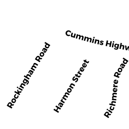
14 Harmon ST
Owner Information
WILLIAMS ESTHER B
14 HARMON ST
MATTAPAN, MA 02126


Property Details
14 Harmon ST is classified as a Single Family Residential (Colonial).
The primary structure on this property was built in 1930. There is 1,410ft2 of residential/living space within this property. This property is listed as having 7 rooms.
14 Harmon ST is valued at $371,600. The land is valued at $165,000 and the structures are valued at $206,600.
The most recent deed for 14 Harmon ST is recorded at the local registrar in Book 20580, Page 248. 14 Harmon ST was last sold on Tuesday, May 21, 1996 for $27,500.
Assessment data from fiscal year 2020.
Flood Data
According to the FEMA National Flood Hazard Layer, this property does not appear to be in a flood zone. It may also be in an area not yet reviewed. Nonetheless, confirm this information prior to taking any action.
To view the flood hazards around this property, create a FEMA "Firmette" Map of the area around 14 Harmon ST.
Broadband Internet Providers
| Provider | Type | Bandwidth (mbps) | |
|---|---|---|---|
| Crown Castle Fiber | Fiber | 0 | 0 |
| VSAT Systems, LLC. | Satellite | 2 | 1 |
| GCI Communication Corp. | Satellite | 0 | 0 |
| Viasat Inc | Satellite | 100 | 3 |
| Verizon New England Inc. | DSL | 7 | 0 |
| Verizon New England Inc. | Fiber | 940 | 880 |
| Comcast | Cable | 1000 | 35 |
| RCN | Cable | 500 | 20 |
| RCN | Cable | 1000 | 20 |
| HughesNet | Satellite | 25 | 3 |
Broadband service provider data from December 2020.
Adjacent Properties
- 20 Harmon ST
Two-Family Residential owned by GANT LOUISE A - RICHMERE RD
Undevelopable Residential Land owned by AUSTIN LAKISHA R - 11 RICHMERE RD
Single Family Residential owned by ROSENFIELD ANNA M - 15 RICHMERE RD
Single Family Residential owned by WILSON DAVID L - Harmon ST
Undevelopable Residential Land owned by WILLIAMS ESTHER B